• What is VOR? What is DME?

If you’d like to become a commercial pilot, you not only need to know how to use all the current navigation systems; but it is also important that you have knowledge about their origins and what it was like to fly aeroplanes in the past. We will therefore look at what is VOR in aviation and also what is DME.

At present, there are a variety of systems that help fly planes, there are planned routes and aeroplanes have sophisticated instrumentation. But how was all this done previously? Stay and find out as it is really interesting… We promise!

Satellite navigation vs traditional navigation

The first thing we’ll talk about is the differences between satellite navigation and traditional navigation.

  • In satellite navigation, pilots fly to a series of designated points by GPS positions, or imaginary points throughout the Earth. This allows planning for much more direct routes, saving time and fuel consumption.
    In order for this type of operation to be carried out, both the aeroplane and the tribulation have to be certified for it.
  • In traditional navigation, the procedure is a little different. Pilots use different types of ground radio aids that allow them to find out what their exact position is.

One of the oldest and well known ones is VOR, alongside DME. Knowing how to use it perfectly is essential for all pilots.

What is VOR?

VOR, VHF Omnidirectional Range, is a ground radio aid that allows pilots to know their position in respect to their corresponding ground station. In Spain, for example, we have 87 VOR stations, spread across all its territory.

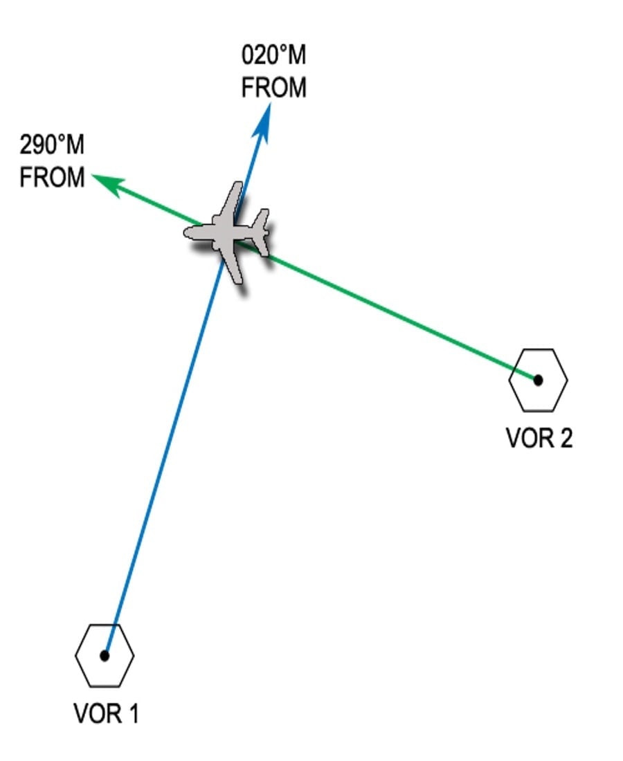
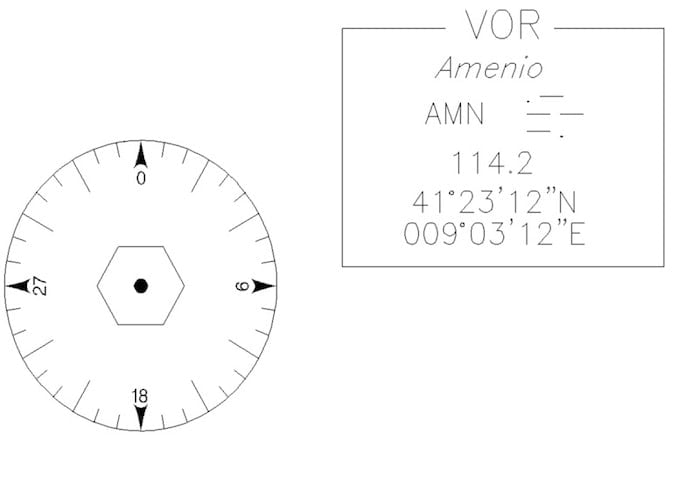
Position with respect to VOR is indicated in radials, which have their beginning in the actual VOR and extend outwards, just like the wheel of a bicycle.

If we incorporate a DME or Distance Measuring System, it is possible to obtain the exact position accurately.

How VORs work?

From a VOR, two different types of signal are emitted: a reference signal, emitted in all directions and a variable signal, emitted in each of the 360º of the station.

The onboard receptor of the aeroplane can compare and obtain the phase between the reference signal and the variable, and in this way, obtain the radial in which the aircraft is.

Each VOR emits these signals in a specific frequency, so if we want to use a VOR in flight we have to tune into its frequency in our navigation equipment.

Identification of VOR

Pilots must be able to identify VOR with whom they’re working. If not, can you imagine if they got confused and followed a different direction, that would be a disaster, wouldn’t it?

To prevent this from occurring, all VOR transmit their identification in Morse code. This code is audible for pilots and they can compare it to the one on the chart.

Aeroplanes equipped with glass cockpits also have screens instead of analogical instrumentation; its avionics actually show you the VOR identifier. So it’s impossible to get confused.

Confusion cone

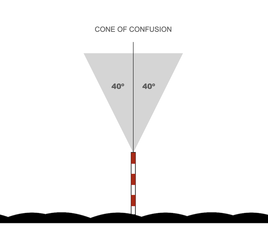
Another VOR phenomenon is the confusion cone.

The confusion cone is the loss of reception from the station when the aeroplane is flying above the vertical. This is due to VOR being designed to give directions for long distances not just in the vertical.

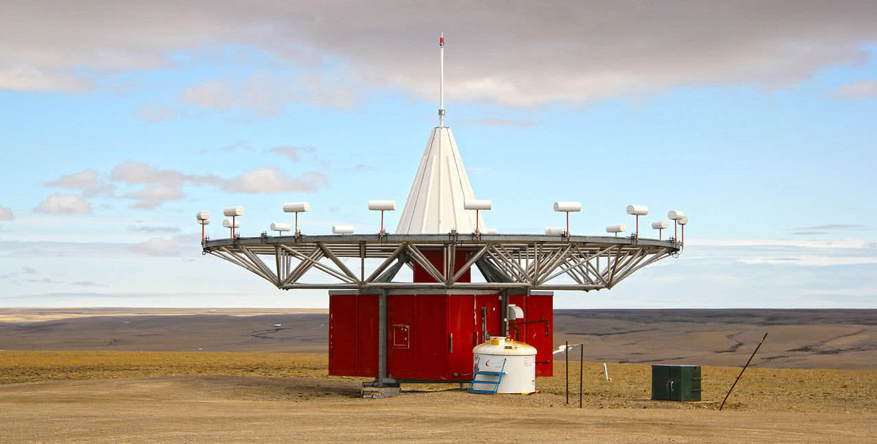
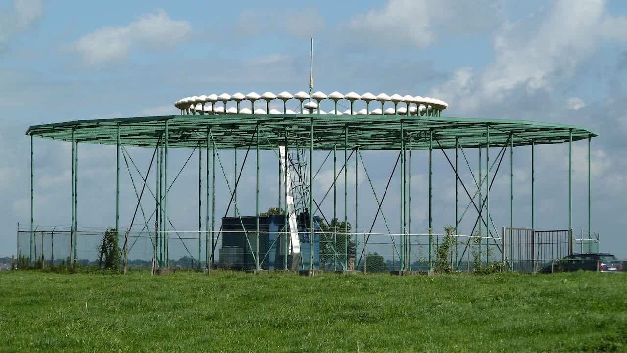
Did you know VOR are like flying saucers?

If you’ve ever seen a structure similar to a flying saucer when driving, It was a VOR as its shape is unmistakable.

What is DME?

We have already touched upon what DME or Data Measurement Equipment is for, haven’t we? Well, now, we are going to look at what DME consists of in a little more detail.

To obtain the distance, the aeroplane emits signals towards DME. These signals propagate through air and are received by the DME.

The DME resends them back to the aeroplane and the onboard systems obtain the distance by measuring time between signals.

Real distance vs slant range

Another one of the curious things about DME is that the distance shown in the instrument is the distance in a straight line from the aeroplane towards the ground station on the ground, what is known as slant range.

This means that if we find ourselves above the DME´s vertical at 6000 feet, our instrument will show a nautical mile although the real distance is 0.

Reach of the VOR

To go from one place to another, pilots have to change VOR as they progress on route but what is the reach of a VOR? How frequently are they changed?

VORs transmit electromagnetic signals in a straight line at the speed of light and in order to calculate the maximum reach, all is needed is the following formula:

Range in nautical miles = 1,23 x (√h1 + √h2)

h1 is the height of the aeroplane and h2 the height of the station, both shown in feet

The importance of instrumental flights

Knowing how VORs work, as well as the other types of radio aids is fundamental for all pilots.

During training, our students practice and learn radionavigation at various times:

  • During PPL theoretical training.
  • During the 5 hours of basic instrumental flying before obtaining the pilot’s private license.
  • In the theoretical part of ATPL.
  • And in the instrumental flying course.

At One Air, we bet on equipping our aircraft with the most powerful avionics available: Garmin G3X for Diamond DA20 and Garmin G1000 for Diamond DA40 and Diamond DA42.

For us, it is essential our pilots practice instrumental flights in a way that is as similar to how it’s done in airlines as possible. We insist on this because it is one of the skills airlines value the most.

Representation of VOR in cabin

The two instruments used for VOR navigation in the cabin are the CDI, Course Deviation Indicator and the HSI, Horizontal Situation Indicator.

Both instruments show in which radial the aeroplane is and whether it is flying towards or from the station.

We could explain here how to use these instruments, but really, it’s almost an impossible mission. You don’t have to worry though, as our instructors will do so perfectly once the time comes.

The future will substitute VORs

Although at the moment VORs are still used as aids for air navigation, the truth is this system is being used less and less.

This is because of the incorporation of satellite navigation which allows the creation of more optimised routes. Additionally, at the same time operational costs for ground infrastructures are reduced significantly.

Furthermore, the advent of the ILS instrument landing system, has substituted VOR as radio aids for the final approach, as ILS offers guidance in the vertical and horizontal planes, increasing safety during the operation.

We hope you have found this post useful and you’ve learnt what VOR are, What DME is and how each of them works.

If you’d like to continue learning about air navigation, we recommend our posts on how to plan a flight route, how aeroplanes’ radios work or how air space is divided.

Please feel free to check out our blog, you will find a lot of interesting information!

You may be interested in…