• What is ILS or Instrument Landing System

What happens when a pilot has to land in bad meteorology? If there’s no visibility, how do they touch down?

Aeroplanes fly long distances from one place in the world to another but they must have a system that allows them to descend safely to airports.

This system is ILS or Instrument Landing System, the landing system by use of instruments; and today we tell you all about it. Please read on.

What is ILS?

Without a doubt, ILS is the most famous aid aeroplanes have in approach. Although we generally refer to it by its acronym, its full name is Instrument Landing System.

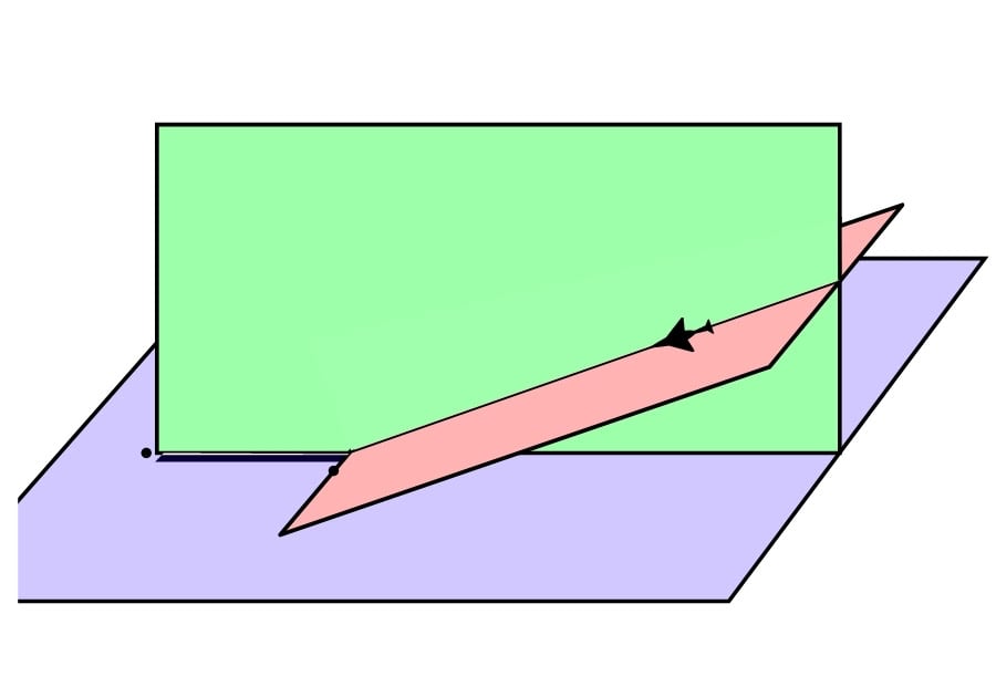
Through ground stations and onboard equipment, ILS provides pilots with vertical and horizontal guidance a few meters prior to touch down, which increases safety in severe weather conditions.

When referring to the vertical plane, it is termed glideslope or glide path and when we refer to the horizontal plane, we call it localiser.

What does ILS work?

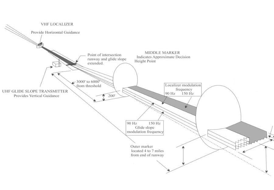
As mentioned earlier, ILS is formed by two signals, one is for vertical guidance and the other one, for horizontal guidance.

The infrastructure for ILS on ground comprises an aerial which provides guidance in the horizontal plane, normally this is 300 metres from the runway end and on the other hand, a second aerial for the vertical plane which can be found in the header of the runway.

Localiser aerials emit between 108.1 MHz and 111.975 MHz and are modulated so that the aeroplane can detect its position with respect to it. If the aeroplane receives a tone of 90 MHz, it will be to the left of the localiser, whereas if it received a tone of 150 MHz, it’ll be on the right.

The aerial that provides information about the glideslope (vertical plane) emits the information at frequencies between 328.6 MHz and 335.4 MHz.

Did you know…?

The ILS transmission frequencies emitted always have odd number decimals: 109.9, 110.3, etc. This is due to ILS and VOR sharing a range of frequencies so that it is easier for pilots to identify them.

Beginning of ILS system in aviation

The beginnings of ILS go back to 1920 when the first systems tests that would allow safer approaches were made in Europe and US, especially on days with adverse weather conditions.

It was not until 24th September 1929 when Lieutenant James Doolittle, on board a Consolidated PT-3, carried out a series of landings in a cabin that was totally covered. It was at this time that the instrumental flight got started.

Three years later, in 1932, Dr. Ernst Kramer de Lorenz patented a system combining horizontal and vertical positioning. This was termed the Lorenz beam.

The Lorenz beam emitted a points and lines frequency where the pilots would hear a continuous sound that would let them know they were in the glide path. Later, a cabin instrument was added, which indicated, through the use of a needle, the relative aeroplane’s position with respect to the path. From then on, things have really changed!

What are the ILS marker beacons

As well as the localiser and the glide path, ILS can offer distance through DMEs or marker beacons.

From a localiser, we can find up to three beacons that allow us to establish the distance at which the aeroplane is on the runway.

🔵 Outer marker:

It can be found at between 4 and 7 miles, corresponds to blue and its identifier is two dashes per second.

🟠 Medium marker:

It is situated 0.6 miles from the runway, is associated with orange and its identifier is dash and dot.

⚪ Internal marker:

Its placement is more optional, it is at 0.24 miles from the runway and its colour is white. Its identifier is dots.

At present, marker beacons are being deactivated, as the majority of ILS have incorporated DMEs. We recommend not missing our post regarding VOR to find out about what DME is.

Landing minimums and frustrated approaches

As mentioned above, ILS allows pilots to descend to a certain height before landing and this is known as a ‘minimum’.

Once minimums are reached, if the runway or its lighting system are visible, landing can continue. If, in contrast, they cannot be seen, pilots would then commence a frustrated approach.

Minimums change according to the airport’s certification as well as the aircraft’s. In some cases they can even be 0 feet; this is what is known as autoland, or the aeroplane landing automatically.

The future of ILS systems

Although it looks like ILS will go on being used in years to come because of the precision and reliability they offer, airports with more complex orography will be substituted by RNAV approaches, as they are more flexible.

We hope you have learnt a little more about ILS and precision approaches and if you’d like to carry on learning, we recommend our post on LVP or low visibility procedures as we are convinced you’ll find it interesting.

You may be interested in…